I had the pleasure of presenting on David Wrisley’s (American U of Beirut) “Geospatial Literary Studies” panel (#782) at MLA this past January. Along with co-presenters Anupam Basu (Washington U, St. Louis), Anne Stachura (U of Texas, Pan-American), and Rachael Scarborough King (UC, Santa Barbara), we traveled through the streets and pages of 18th century London, then to the 2009 H1N1 epidemic, the 19th century NYC bookstore and, finally, back to the 18th century with continental diplomatic dispatches. It was a great ride.
For a storify of Tweets from the session, click here.
And for another view on the panel and geocritical approaches to literature, as well as information on a proposed follow-up Special Session for MLA 2015 (“Geocritical Explorations Within the Text”), see Moacir P. de Sá Pereira’s (U of Chicago) blog post here.
The abstract for my talk, “Locating the Bookstore: Antebellum Literary Landscapes and Contemporary Interpretive Practice,” appears below.
Abstract for Session, “Geospatial Literary Studies”
“Locating the Bookstore: Antebellum Literary Landscapes and Contemporary Interpretive Practice”
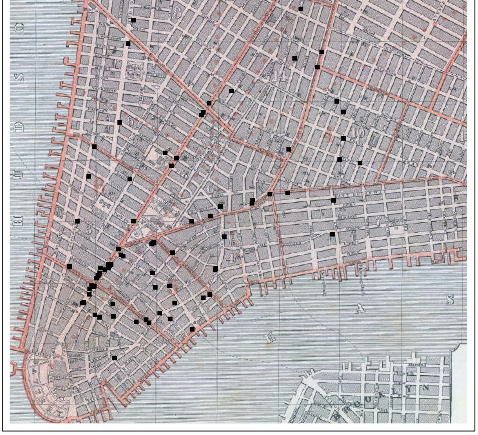
Recent research in literary studies acknowledges the significance of the spaces of reading to the formation and function of literary cultures, yet has entirely neglected the bookstore as one of these formative spaces. By focusing on and surveying the bookstore as a specific literary space, I argue for the radical materiality of literary and cultural experience and explore interpretive practices and methods for analyzing and describing a local geography of culture. My presentation for the “Geospatial Literary Studies” panel will focus on two related projects: one a methodological and historical project mapping the bookstore in the physical and cultural space of antebellum New York City, and another a disciplinary project to emplace the bookstore and other commercial forms in literary studies.
Informed by location data contained in city directories, advertisements, and book catalogues, GIS technology offers a new and rich perspective of the literary landscape of antebellum New York City. Using original maps created and animated through ArcGIS and plotting the locations and movements of bookstores, I will explore the unique patterns, insights, and questions suggested by a geographic analysis of antebellum bookstores with larger implications for understanding the commercial topography of the antebellum book trade and the various functions of book spaces in the cultural geography of an expanding urban center. Further, by grounding discussion of literary culture in a specific public institution and focusing on physical and cultural geography, a number of understudied genres, such as trade cards, fire insurance maps, and commercial panoramas emerge as significant contemporary methods that both document the bookstore and attempt to map and read urban space. Considered as interpretive practices alongside digital GIS, these genres—currently overlooked by literary scholars—emerge as valuable cultural productions. In seeking a more complete image of nineteenth-century New York City’s literary and cultural topography by making visible the networks and geographies in which bookstores operated, my presentation will demonstrate the promises and challenges of exploring the spatial dimensions of literary culture.